
Desk note · Data · Research
More Than One in Four Idaho ZIP Codes Cross a County Line
Seventy-two Idaho ZIP codes reach into two or more counties, including ones in Star, Nampa, Eagle, Boise, Pocatello and Sandpoint. The county, not the ZIP, decides where you vote and part of what your car registration costs.
Based on public records and Census data. No interviews were conducted. Disclosure: the ZipBounds lookup linked below was built by Samuel Torres, the editor of The Idaho Stack. The counts here come straight from the Census file.
Of the 280 ZIP codes the Census Bureau maps mostly inside Idaho, 72 reach into more than one county, counting a county only when it holds at least 1 percent of a ZIP’s land. Thirteen touch three. Counting every sliver, the total is 85. Three cross a state line: Freedom’s 83120 into Lincoln County, Wyoming; Malta’s 83342 into Box Elder County, Utah; and Priest River’s 83856 into Pend Oreille County, Washington. Six ZIP codes from neighboring states also reach into Idaho. Nearly half the land in Thayne, Wyoming’s 83127 lies in Caribou County.
The splits run through some of Idaho’s larger towns, not only open country:
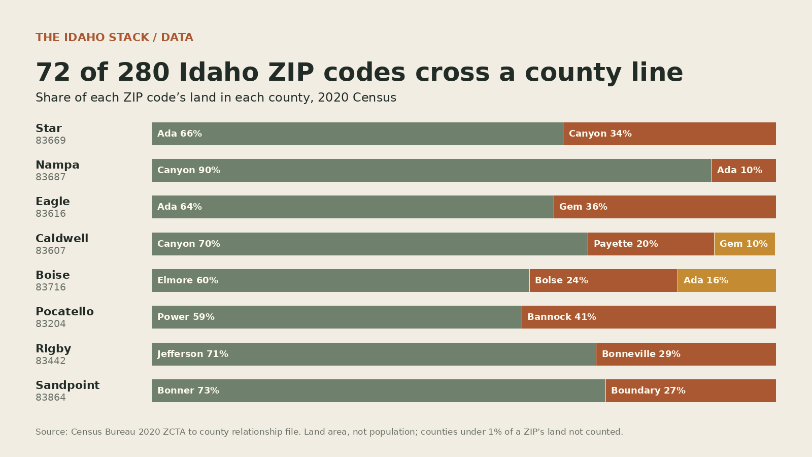
More examples, with exact shares:
| ZIP | Post office | Counties, by share of the ZIP’s land |
|---|---|---|
| 83669 | Star | Ada 65.9% · Canyon 34.1% |
| 83687 | Nampa | Canyon 89.7% · Ada 10.3% |
| 83616 | Eagle | Ada 64.4% · Gem 35.6% |
| 83607 | Caldwell | Canyon 69.9% · Payette 20.2% · Gem 9.8% |
| 83716 | Boise | Elmore 60.5% · Boise 23.8% · Ada 15.7% |
| 83204 | Pocatello | Power 59.3% · Bannock 40.7% |
| 83442 | Rigby | Jefferson 71.2% · Bonneville 28.8% |
| 83638 | McCall | Valley 52.0% · Idaho 47.4% |
| 83864 | Sandpoint | Bonner 72.7% · Boundary 27.3% |
| 83869 | Spirit Lake | Kootenai 56.5% · Bonner 43.5% |
| 83350 | Rupert | Minidoka 82.0% · Blaine 11.0% · Cassia 6.9% |
Two of them stand out. Boise’s 83716 is mostly Elmore County land, and Pocatello’s 83204 is mostly Power County. Closer to home, every Wood River Valley ZIP code, from Ketchum to Carey, sits entirely inside Blaine County. Blaine’s county line is crossed from the south instead, by Rupert’s 83350 and, barely, Shoshone’s 83352.
These are shares of land, not of people. The Census Bureau’s 2020 relationship files “do not include housing or population counts,” so a ZIP that is a third Canyon County by area could have most of its residents on either side. Only an address settles it.
Why the county matters
Voting. Idaho’s elections are run by the clerks of its 44 counties, and the Secretary of State says each voter is “assigned a specific voting location based on your physical address.” Two neighbors with the same ZIP can live in different counties, with different county races on the ballot.
Car registration. The Idaho Transportation Department lists “your county of residence” among the things that set a registration’s cost, and county administration fees differ: $9.50 in Ada and Canyon, $8.00 in Bonneville, $7.25 in Blaine. Ada County adds the Ada County Highway District’s fee, $24 to $40 for most passenger vehicles depending on age, which pays for Ada County roads. In Star, Eagle or Nampa, the ZIP alone can’t tell a household whether it pays.
Resort-city taxes. Twenty-three Idaho resort cities, including Hailey, Ketchum, Sun Valley, Bellevue, McCall and Sandpoint, levy a local sales tax on top of the state’s. The Tax Commission tells taxpayers to contact each city directly. A ZIP code is a mail route, not a city limit, so a Hailey mailing address doesn’t settle whether a sale happens inside Hailey.
Data. The Census Bureau calls its ZIP areas “generalized areal representations” of mail delivery. Anyone who rolls a ZIP-coded list up to counties, whether customer records, case counts or a grant application, will put some of these 72 ZIPs in the wrong place. The fix is to match full street addresses to counties. With only ZIPs, split the multi-county ones by their shares and say so.
What this doesn’t show
How many residents live on each side of a line, which needs address-level data the relationship file doesn’t carry. It also leaves out ZIP codes with no Census area, since “not all valid ZIP Codes are represented by a 2020 ZCTA,” and county slivers under 1 percent of a ZIP’s land.
Sources and limits
Public records reviewed November 9, 2026.
- Census Bureau, 2020 ZCTA to county relationship file, land area of each ZIP-county part; all counts and shares in this note
- Census Bureau, ZIP Code Tabulation Areas
- Census Bureau, 2020 relationship files
- VoteIdaho, casting your ballot and county clerks
- Idaho Transportation Department, vehicle registrations, including county registration and title fees
- Ada County Highway District, vehicle registration fee
- Idaho State Tax Commission, city sales taxes
- To look up one ZIP: ZipBounds ZIP to county lookup, built from the same Census file by the editor (see disclosure). It lists counties down to 0.5 percent of a ZIP’s land, so it can show a sliver this note leaves out.
“ZIP” here means a Census ZIP Code Tabulation Area mostly in Idaho. ZCTAs approximate U.S. Postal Service ZIP codes; they are built from 2020 census blocks, using the ZIP code most addresses in each block had, so they can differ from today’s mail routes. Shares are of land area, rounded to a tenth of a percent.